Myanmar's Indaw/Chindwin area has Tertiary, Cretaceous targets
Ed F. Durkee
E.F. Durkee & Associates Inc.
Manila
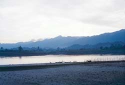
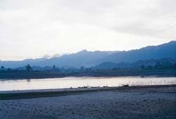
East-dipping Miocene sandstone ranges, view south on Chindwin River at sunset, taken just north of Kalewa (Fig. 1).Pacrim Energy NL of Brisbane, Queensland, Australia, signed production sharing contracts on July 21, 1997, with Myanmar to explore two blocks (Fig. 1 in previous article).
The blocks are known as C-1 (Indaw) and RSF-9 (Pyalo).
RSF-9 comprises 600,229 acres in the old Central Burma oil belt. It lies east of the Ayeyerwady (Irrawaddy) River north of Prome oil field, about 180 miles northwest of Yangon (Rangoon).
RSF-9 has one depleted and/or not fully developed gas field, at Pyalo. The block is very lightly explored. Its width is transected by three major southeasterly trending anticlinal trends that will require seismic exploration and the drilling of new wells.
Block C-1, modified and enlarged relative to the earlier Block C-1, once held by Yukong Ltd. of Korea in 1989-94, now embraces nearly 4.8 million acres. The block is in Northwest Myanmar, and its center is about 150 miles northwest of Mandalay in the remote Chindwin basin. It is this area that is the subject of this article.
The block was extended to the east to include the Mettaung thrust belt and to the north to include the Yenan anticline, west of the Chindwin River.
Chindwin basin
The Chindwin basin of Northwest Myanmar (Fig. 1 in previous article) for more than 100 years has been recognized by those relatively few geologists to visit the region as a magnificent geological sight.The beauty of the scenery is captivating as one views it from the surface of the mighty south-flowing Chindwin River (Fig. 1 [5,739 bytes]).
The terrain bounding the river in this region comprises spectacular north-trending Eocene and Miocene steep, east-dipping dip slopes of sandstones on the west side of the river. These rows of parallel ridges, serrate in crestal profile, rise in places to elevation 3,000 ft above the Chindwin. To the east of the river are prominent west-facing escarpments or bluffs of gentler east-dipping Upper Miocene and Pliocene sandstones extending for many miles like walls along the river's course.
The entire region is luxuriantly forested for the most part; in places too much forest-at least for a field geologist-a jungle of teak, various deciduous trees, and almost impenetrable mazes of bamboo near water courses.
On the west margin of the Chindwin basin between Kalewa and Kalemyo towns, the Myittha River, an antecedent stream, traverses almost due east across the outcrop belt. The Myittha River gorge affords both touristic vistas as well as good geological exposures of nearly 56,000 ft of measured Cretaceous to Pliocene sedimentary rocks (Fig. 2 [124,465 bytes]). These rocks are all dipping eastward in a magnificent display. It is along this outcrop section that the many oil shows and shallow wells featured in the previous article in this issue of OGJ occur.
Chindwin prospects
The most outstanding oil and gas prospect on Block C-1 is the giant Indaw anticline (Fig. 3 [224,761 bytes]).This feature has been known only since the turn of the century and is reportedly the site of some pioneering exploration work as early as 1912.
Lying in the densely forested terranes of moderate elevation but ruggedly dissected, 25 miles east of the Chindwin River, it was not only remote, it was a malarial zone featuring wild elephants, tigers, and few inhabitants. Thus, it seems to have several of the prerequisites for an oil field ...
Surface manifestations in the form of two major "gas lakes," or collapsed mud volcanoes near the crest of the Indaw anticline likely called this region to the attention of early geologists. The author had the opportunity to visit the northernmost of these unusual features in February 1997 (Fig. 4 [10,989 bytes]) "Gas lake" or collapsed mud volcano ("caldera") on crest of Indaw anticline, Mawtongyi Chaung (creek), about 1,000 ft east of Yukong Indaw 1 well.
Indo Burman Petroleum Co., commencing in 1918, developed a small, shallow oil field at Indaw. This field produced until early 1942, when it was essentially destroyed in the face of the Japanese army's advance into Burma during World War II. The field produced about 1.2 million bbl of oil from shallow, discontinuous Miocene sandstone reservoirs 800-1,200 ft deep.
About 75 wells were drilled in a localized area near Indaw village at the confluence of the large west-flowing Kodan Chaung (creek) and the north-flowing tributary Mawtongyi Chaung. The field area was small and the wells not very prolific (a few barrels to perhaps 10-12 b/d at best).
The field's total daily production peaked in 1930 at about 230 b/d. The field supported a 3 in. pipeline built 25 miles westward to a small refinery on the east bank of the Chindwin River near Pantha village.
One of the best accounts (maybe the only account) of life in this remote field is described in Cecil Thomas Barber's 1974 book, "A Geologist in the Service of the Raj." He visited the field for ten days in 1930, and his map, published in 1935 as a result of that investigation, is shown on Fig. 5 [126,505 bytes].
The core of structure that he defined by a quartz pebble bed is essentially the area shown on later maps (Fig. 3) as the Natma formation. The central part of the structure along the east side of the crest displays a steep dip (60-80°) zone believed to be near the surface trace of a thrust fault that hades to the west and then soles out at depths below 7,000 ft.
As seen today, the surface structure is very large, extending nearly 45 miles overall in a northerly direction, and based on form-line contouring is about 5 miles wide. Because of the meager production and poor economics, Indaw field was never rehabilitated after WWII. The early production was, however, seen by some as possibly being something that had leaked upwards from deeper reservoirs.
Geological objectives
Two deeper tests have been attempted, both failures because of drilling problems in overpressured section.Burmah Oil Co.'s Indaw 76 well was drilled in 1963 to a depth of 7,425 ft. In 1991, following a limited helicopter seismic survey, Yukong drilled its Indaw 1 about 3 miles south of Burmah's test, to a depth of 9,435 ft.
Seismic data and well data made by Yukong suggest a cross-section picture as shown on the geologic interpretation along seismic line YK-90-11 near the Yukong well (Fig. 6 [134,677 bytes]). The structure probably has more than 1,000 ft of vertical closure and many square miles of areal closure.
The principal objective is believed to be sandstones within the Eocene Podaung formation in the interval between 10,000 and 15,000 ft on the subthrust crest of the structure. The presence of oil saturated outcrops, oil and gas seeps, and shallow wells along the Eocene outcrops for a distance of 100 miles in a north-south direction about 40 miles west of Indaw tend to give this postulation some substance (Fig. 7 [100,780 bytes]).
A giant to supergiant oil or gas field still remains to be tested at Indaw. This will be one of Pacrim's major targets.
In other parts of the block there are possibilities of large fault traps on the south plunge of the Indaw anticline, unexplored closures along the Mettaung thrust in the east part of the block, and the very large Yenan anticline in the western outcrop belt west of the Chindwin River.
This feature was surveyed seismically by Amoco but not drilled prior to that company's departure from Myanmar. Yenan appears to be one place where a well can be drilled to test the Cretaceous, which has never been done in Myanmar.
Copyright 1997 Oil & Gas Journal. All Rights Reserved.

