A geological assessment: What's ahead for Louisiana Austin chalk
William T. Maloy
Centerline Oil & Gas Inc.
San Antonio
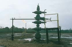
A Sonat Exploration Co. Austin chalk producing lease in Burr Ferry North Field, Vernon Parish, La.Both noteworthy and recent, the extension of the Austin chalk horizontal drilling play into Louisiana has been as closely watched as it has been controversial.
The play has been controversial for the critics who claim the Louisiana chalk boom is simply the latest chapter in the chalk's boom and bust history.
The play is closely watched by chalk enthusiasts who have seen Louisiana horizontal wells yield as much as 80,000 bbl of oil and 250 MMcf of gas in a single month.
Who is right? How will the play develop? This article will present a geological assessment (Fig. 1 [40032 bytes]) of the play and offer some insights into the future of horizontal drilling in Louisiana.
Background, overview
Cliffs Oil & Gas completed the first horizontal Austin chalk well in Louisiana in 1991. Since then, 134 horizontal wells have been either drilled or permitted.1
Geographically the trend extends through Texas and runs across central Louisiana to the Gulf of Mexico (Fig. 2 [33669 bytes]). Drilling in the play includes an area that is more than 125 miles long and 30 miles wide.2
Participants of Austin chalk drilling are projecting significant Louisiana production-with estimates of ultimate reserves at 7 tcf of gas equivalent3 across as much as 3 million prospective acres.4
Interest in the play has helped move the active rig count to 24. Obviously, the Louisiana Austin chalk is now one of the hottest plays along the Gulf Coast.
To understand the merits of this play, it is vital to establish a geological model that defines the search for fractured chalk reservoir. However, for perspective, it is helpful to reflect on Texas chalk exploration, which began 60 years ago.
The Texas Austin chalk has been a financially marginal play that developed in cycles booming or busting with changes in oil prices or advances in drilling or completion technologies. Although the Austin chalk is fractured along the entire Texas trend, commercial production is limited to "sweet spots" where fracture density is greatest. Only the most astute chalk operators have achieved risk-adjusted commercial returns.
Louisiana should be no different from Texas in the sense that only selected geological "sweet spots" will yield commercial production. Blanket, statewide drilling campaigns espoused by some operators will be no more successful than they would have been in Texas.
Early industry speculation about the Louisiana play offered the assumption that the Austin chalk trend was a 30+ mile wide, continuous, undeveloped field across the entire state. This concept simply does not reflect the results of recent drilling activity.
Currently, commercial Louisiana Austin chalk production is restricted to a relatively narrow area between Burr Ferry North field in Vernon Parish-which is near the Texas-Louisiana line-and nearby Masters Creek field in Rapides Parish.
This article challenges the concept of a Louisiana statewide Austin chalk field. In its place, it will present the notion of a play that is defined by geological subtrends composed of variable fracture density and reservoir performance.
Sub-trend analysis
The Louisiana Austin chalk trend can be divided into four sub-trends, each with a reference to the underlying Edwards shelf margin (Figs. 1, 3).
The Edwards shelf margin is the most dominant megatonic feature within the trend and appears to have significant influence and control (relationship) on fracturing within the Austin chalk. A positive correlation between "reef setting" and horizontal Austin chalk production supports this division and offers insight into future opportunities for discovery.
1. Back reef-shelf. In south and central Texas all Austin chalk production is found behind the axis of the Edwards shelf margin. This productive trend coincides with a structural hinge line where regional fractures formed as a result of extension of the chalk due to subsidence into the ancestral Gulf Coast basin. In various fields, the reservoir is enhanced by tectonic fractures genetically related to local structure. However, it is noteworthy that Austin chalk production from the back reef-shelf terminates near the East Texas basin (Fig. 1).
Horizontal wells drilled in this sub-trend in East Texas and Louisiana have encountered high water cuts, marginal production rates, or an absence of significant fracturing. In Louisiana six horizontal wells have been drilled on the back reef-shelf. Of these six exploratory wells, five are dry holes, and the other well is noncommercial. The early results of this drilling suggest that a significant portion of the Louisiana Austin chalk trend covering the back reef-shelf can be considered high risk.
2. Reef-shelf margin. The Lower Cretaceous Edwards barrier reef formed on a relatively stable shelf margin, reaching a thickness in some places in excess of 1,000 ft. The reef trend in Louisiana is approximately 8 miles wide and is defined by a structural position immediately overlying the Edwards Reef facies (Fig. 1).
Production has been established along the reef trend in Brookeland field in East Texas and Burr Ferry North field just across the line in Louisiana. The production from these Austin chalk reservoirs is attributed to fracturing associated with draping over the Edwards reef.
More than 25% of all Louisiana horizontal Austin chalk wells have been drilled on top of the underlying Edwards reef. This drilling is concentrated in Burr Ferry North field. Production in this field varies from excellent to poor but in the aggregate appears marginal. An engineering study of 26 completions in Burr Ferry North field resulted in estimated ultimate recovery of 146,200 bbl of oil equivalent per well.5
Several recent efforts to extend "reef trend" production eastward from Burr Ferry North field have proven unsuccessful and therefore, at this writing, no new wildcat wells are permitted in this sub-trend.
3. Near fore reef-upper shelf slope. The near fore reef trend extends in a band whose width is herein defined by the gulf-facing edge of the Lower Cretaceous Edwards shelf, extending about six miles to the south into the shelf slope (Fig. 1).
Tremendous expansion in the immediately underlying Tuscaloosa clastics influenced normal faulting and associated fracturing in the Austin chalk. In theory, these extension fractures would be most concentrated at points nearest to the shelf edge and would diminish toward the basin.
Bayou Jack, Masters Creek, and downdip Brookeland fields all fall within this fairway. This 6 mile wide zone appears to have the greatest potential for new discoveries and is currently the focus of Louisiana horizontal chalk drilling activity.
4. Far fore reef-lower shelf slope. The far fore reef shelf slope extends toward the gulf basin in a southerly direction from the near fore reef trend. Fracturing in the Austin chalk is associated with normal faulting due to subsidence and, in eastern Louisiana, salt movement in the basin.
Wells drilled in the far fore reef are deep, usually 15,000 ft or more, and these wells encounter hostile drilling conditions. Approximately 24 wells have been permitted in this trend. Of the 24 wells, three completions have been reported and two appear to be dry holes.
Test results of the UPRC 1-8 Crosby, which flowed 4,200 b/d of oil and 22 MMcfd of gas at 7,500 psi, attest to the potential of this part of the trend. However, apparent dry holes such as the UPRC 2 Planters and Chesapeake 1-33 Riceland and completion problems such as those experienced by the Belco 1 Turner attest to the riskiness of the far fore reef play.
Additional drilling technology enhancements and production history are all required to further evaluate the commercial viability of the far fore reef trend.
5. Eastern-western provinces. The proposed model does not consider obvious structural and stratigraphic changes that occur along strike (east-west).
Montgomery6 describes "the correspondence of thick lower Tuscaloosa clastics, deep Louann salt and major growth faulting," and various stratigraphic changes within the Austin chalk as being unique to the eastern part of the state. The division occurs at approximately the line between Rapides and Avoyelles parishes where the South Louisiana Salt Dome basin and Growth Fault trend extend updip into the shelf edge (Fig. 1).
Efforts to extend commercial Austin chalk production into the eastern parishes have as yet proved unsuccessful. Because of this strong relationship, the model proposes to additionally divide the trend into eastern and western provinces (Fig. 2).
Conclusion
The Louisiana horizontal Austin chalk drilling trend stretches for over 125 miles in length and over 30 miles in width. Commercial production, though, is limited at this time to a relatively small area between Burr Ferry North and Masters Creek fields.
The dominant megatectonic feature along the trend is the Edwards reef, which appears to have a significant relationship to fracturing in the overlying Austin chalk. In order to narrow the search for potential reservoir, a geological model has been developed. The model divides the Louisiana Austin chalk trend into four sub-trends and an eastern and western pro- vince, each with its own set of exploration opportunities and risks.
Based on this model, the near fore reef trend holds the greatest opportunity for future discovery. The reef and far fore reef trends also offer potential for new reserves, but based on available drilling and completion reports have increased economic risk. The back reef trend has limited attractions to the explorationist.
Additionally, in all sub-trends east of Rapides Parish (eastern province), changes in structure and stratigraphy appear to significantly increase the risk of a successful Austin chalk completion.
It is evident that like Texas, Louisiana Austin chalk production will develop along sweet spots. Narrowing the "play" to the most fractured areas will be critical to commercial success.
References
1. Petroleum Information/Dwights LLC, Houston edition, through Apr. 16, 1997.
2. Zimmerman, Louisiana State University Basin Research Institute Bull., Vol. 6, 196, p. 3.
3. McClendon, A., OGJ, Dec. 23, 1996, p. 24.
4. Vering, AAPG Explorer, May 1996, p. 20.
5. Gary S. Swindell & Associates Petroleum Engineering, Dallas.
6. Montgomery, S.L., Petroleum Frontiers, Petroleum Information Corp., Vol. 12, No. 3, 1995, p. 46.
The Author
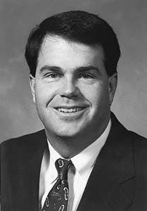
William T. Maloy is president and owner of Centerline Oil & Gas Inc., a petroleum exploration and consulting company. He previously worked for Christico Petroleum Co. and earlier Clayton W. Williams Jr. Inc., where he was division geologist in charge of the Texas Gulf Coast region. Maloy has a BS degree in geology from Texas A&M University and an MBA from the University of Texas at Austin. He has held several positions in the South Texas Geological Society.
Copyright 1997 Oil & Gas Journal. All Rights Reserved.


