OIL HISTORY, POTENTIAL CONVERGE IN AZERBAIJAN
A.A. Narimanov
State Oil Co. of Azerbaijan
Baku
Ibrahim Palaz
Amoco Production Co.
Houston
State Oil Co. of Azerbaijan (Socar) signed a multi-billion dollar production sharing agreement in September 1994 with a consortium of primarily western oil companies to develop three oil fields in the Caspian Sea. Soon, Azerbaijan will offer new exploration acreage both offshore and onshore, probably creating a very competitive business environment for western energy companies.
HISTORY
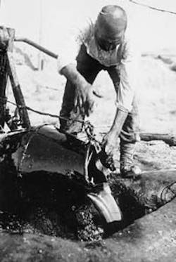
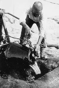
Drilling of the first oil well in history was initiated by a Russian engineer, F. N. Semyenov, in the Bibi-Eibat area of the Apsheron Peninsula in 1848. At the end of the 19th century and the beginning of the 20th century, a well was drilled offshore to develop the offshore part of this field. This was the first offshore well in the world.
Though Pirallahi offshore field has been under development since 1901 from an island, true offshore development began in 1924, when a wooden platform was constructed not far from Baku for drilling of a production well-another first for Azerbaijan and the world.
PRODUCTION
By 1830 there were about 116 operating wells with 3,840 metric tons of ultimate annual production from Apsheron Peninsula. Baku oil was transported to Georgia, Daghestan, Russia, Iran, Central Asia, and Armenia. Beginning in 1840, oil and kerosine from Baku were shipped to the town of Astrahkan in the North Caspian region, and further on via the Volga River to towns in Russia in metal 20 pud barrels (a pud is an old Russian unit for dry and liquid measure equivalent to 16 1. or 16 kg).
In 1877, "Zoroaster," the first steam tanker in the world with a steel hull, was used for kerosine transportation. In 1886, the "Svet" steam tanker delivered Baku kerosine from Batumi, a port on the Black Sea, to London. By the end of 1870, only 12 companies were involved in production of oil from the region. These companies were owned by Russian industrialists Mirzayev Tagiyev, Kokorev, Bekendorf, Vermisher, and others. Their total annual production in 1881 was 656,000 tons, or 15.5% of the world's production at the time.
Later on, entrepreneurs emerged, and intensive development of the Apsheron oil fields began. In less than 20 years, the number of companies in the Baku oil business increased to 146, and total production jumped to 11 million tons/year, which was 48.6% of the world's total. Large companies owned by financially powerful outsiders, such as the Nobel family of Sweden, the Rothchilds of France, and James Vishov of England, produced oil in this ,period. After 1907, a pipeline delivered Baku oil to Batumi.
For a long time, Azerbaijan was the major oil producing region of the former Soviet Union. In 1913, Azerbaijan produced 83% of all oil in the countries that later belonged to the U.S.S.R. At this time, 14% of oil production was from Ganzy, and 3% from a combination of the Amba region of Kazakhstan, Western Turkmenistan, and the Fergana region of Uzbekistan. Azerbaijan oil production peaked in 1941 at 23.5 million tons/year, or 71.4% of the Soviet Union's total production.
OFFSHORE DEVELOPMENT
Serious study of Caspian Sea geological structures began only after drilling of the first well offshore, where oil was seeping at the seafloor from outcropping sand bars.
The Kalinsakaya suite of the middle Pliocene produced 100 tons/day of oil. These sand bars gave the new oil field its name: Neft Dashlari, or Oil Rocks.
Intensive geological exploration in the 1950s resulted in discovery of a series of oil and gas/condensate fields, which totaled 33 by the end of 1993. One of the fields is in the western shelf of the middle Caspian at the border of the Terskpo-Caspian edge depression near the Daghestan coast. Another was at the east shelf of the middle Caspian near the Kazakhstan coast.
The other 31 discoveries were within the south Caspian shelf at the northwestern and northern part of the South Caspian Depression. These included seven fields in the Turkmenistan sector in the area of the Apsheron-Pribalakhany Uplift. Azerbaijani petroleum engineers and geoscientists directly contributed to the discoveries of 31 out of 33 fields.
By the end of 1993, a total of 57 areas had been under exploration, and 930 wells had been drilled in the Caspian Sea. A total of 180 wells penetrated to 5 km or deeper, and 30 of these were deeper thin 6 km. The Umid 4 is the deepest well on the Eurasian shelf, with a total depth of 6,715 m.
Drilling of superdeep wells reached its climax between 1976 and 1981, when 56 wells were drilled with an average depth of 5,623 m on the western shelf of the South Caspian. The effort added to knowledge on tectonics, lithologic attributes, thermobaric conditions, and other features of deeper stratigraphic units and led to revisions of geological concepts of the South Caspian basin.
Deep wells such as the 79 Bahar, drilled to below 5 km, and 6 Bahar, deeper than 6 km, produced discoveries such as Bahar field, which produced from the middle Pliocene PK suite at a depth of 5,200 m. Oil also was discovered in the Hara Zira area at a depth of 5,756 m, and condensate was discovered in Bulla-Deniz field at a depth of 6,123 m.
As drilling moved into deeper waters, a discovery in the 4 Guneshli well, drilled from fixed platform No. 1, stimulated seismic activity and led to other large discoveries, such as Chirag field in 1985, Azeri field in 1987, and Kepez field in 1988.
Technological improvements helped geophysical exploration in this period and extended the depth of seismic exploration to 7-8 km. Tighter seismic grids and improved data quality, coupled with drilling and acoustic logging improvements, enabled earth scientists to refine tectonic and geological concepts of the Caspian basin. Besides seismic facies analysis, identification of stratigraphic traps became a routine procedure.
At present, two fields in Turkmenistan and 17 fields on the Azerbaijan side are on production in the Caspian Sea. Total production averages 9 million tons/year of oil and 8 million cu m/year of natural gas.
Using three semisubmersibles and six jack ups, Socar is exploring in water as deep as 200 m. It is targeting oil and gas deposits at depths of 6-8 km, such as those in Shah-Deniz and Umid fields. Other targets for Socar are structural and stratigraphic traps in Pliocene formations in the South Caspian as well as structural and stratigraphic traps of Tertiary and Mesozoic rocks at accessible depths in the North Apsheron basin.
Remaining to be tested are 53 anticlines in Caspian waters deeper than 200 m. Some of these structures are believed to hold potential for large hydrocarbon discoveries.
TECTONICS, STRATIGRAPHY
Azerbaijan is located on the Greater Caucasus-Kopet Dag portion of the Alpine-Himalayan fold belt, which is the result of a collision between the Arabian, Iranian, and Indian microplates of Gondwanaland and Eurasia.1
The regional structure of the Greater Caucasus is dominated by a series of south verging nappes, which represent part of a long period of compressional tectonism initiated by active volcanism. Thrusting within the nappes during Late Miocene time lifted Cretaceous rocks over the Pliocene deposits on the Greater Caucasus.
While the motion over Greater Caucasus is compressional, the motion over Kopet Dag on the eastern part of the Caspian is a predominantly strike-slip. However, over the Apsheron Ridge in the central Caspian Sea, a very complicated manifestation of both compressional and strike-slip motions can be seen. In principle, it is accurate to assume that Apsheron Ridge is a continuation of the Greater Caucasus, with a very thick and young sedimentary cover.
A generalized stratigraphic column, compiled from Azeri literature, is shown in Fig. 2 (178485 bytes). While marine Jurassic and Cretaceous sediments make up most of the Greater Caucasus, the Lesser Caucasus are composed mainly of igneous and sedimentary rocks of similar age along with metamorphosed Precambrian sediments.
Cenozoic sediments fill the Kura Depression, similar to the South and Central Caspian Sea. Alluvial and marine Quaternary sediments make up the surface over the Kura intermountain trough. The primary reservoir rocks of onshore and offshore Azerbaijan oil fields are from the middle Pliocene Productive Series.
Fig. 3 (51123 bytes) is a generalized paleogeographic map illustrating the middle Pliocene basin boundary.
PETROLEUM SYSTEM
A comprehensive, western-style petroleum system study has not been completed for the South Caspian basin. This is partly due to lack of data or poor quality of available data.
Based on incomplete studies, a summary of findings over the past several years has been made. Primary source rock appears to be the Oligo-Miocene Maykop series. However, early Cenozoic and Mesozoic source possibilities have not been ruled out.
Outcrop samples of Maykop series have a total organic content (TOC) of 1.2% to more than 10%. The thicknesses of these series range from 100 m to 2,500 m. Alizade reported thickness of Maykop near the Lesser Caucasus up to 3,500 m.2
Nearly a dozen multibillion bbl oil fields indicate that the South Caspian is a very prolific basin with a rich source and effective generation and migration properties. Faults on or near the diapirs or mud volcanoes are primary conduits for vertical migration of hydrocarbons. However, horizontal migration must have also been an important factor for such large accumulation of hydrocarbons in numerous structures.
Reservoir quality is often the biggest concern for explorationists in Azerbaijan. For predicting quality of primary reservoir sands, it is critical to understand controlling factors for depositional environments: source terrain, transportation distance, geometry of the sand deposits.
As shown in Fig. 3 (51123 bytes), the Paleo Volga, Kura, Sefidrud, and Amu Derya were among major river systems providing sediments to the middle Pliocene Caspian basin. Studies indicate that the sands of the Productive Series, deposited primarily by the Paleo Volga, seem to be rich in quartz content and have better porosity. Sands deposited primarily by Paleo Kura seem to have more feldspar and volcanic ash and consequently relatively poor porosity and permeability.3 Productive Series has more than eight sandy units over the Apsheron Ridge. In the south near Nefthechala, the number of sandy units is lower.
MUD VOLCANOES
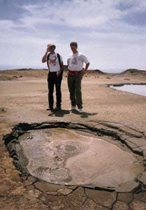
A significant percentage of the world's mud volcanoes are found in Azerbaijan.
Intense mud volcanic activity started 2.5 million years ago, and most volcanoes remain active.
Mud volcanoes are particularly concentrated where high Pliocene sedimentation rates were able to keep up with rapid subsidence.
Significant diapiric movement of up to 3,000 m on these volcanoes occurred relatively late in time (post-Akchagyl).
In the Locbatan region of Azerbaijan, south of Baku, volcanic breccias as old as Mesozoic age can be found near the volcanoes.
FIELD EXAMPLES
Following are descriptions of some of Azerbaijan's producing areas:
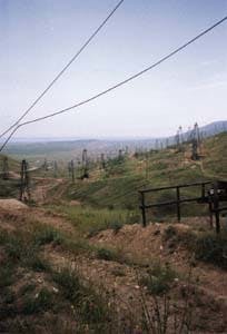
- The Balakhany-Sabunchy-Romany fields are located in the central part of the Apsheron Peninsula, 10 km northeast of Baku. These fields, discovered in 1871, are some of the oldest fields in the world.
They are confined to a 7-10 x 3-4 km brachyanticline at the southeastern depression of the Greater Caucasus. The brachyanticline is distinctly asymmetric, with a dip angle of 60 80 on the southwestern side and a dip angle of 24-25 on the northeastern side. The fold is complicated by a number of strike and dip-oriented faults. In the lower part of the producing section primarily strike-oriented faults are developed.
In these fields, all sandy units of the Productive Series have pay; however, primary production comes from Sabunchy, Balakhany, Upper Kirmaky, Kirmaky, and Lower Kirmaky. Surakhany suite formations are slightly oil-saturated. Fields have a total of 28 pay horizons with no gas cap.
These fields produce a light oil, with a density of 0.865-0.875 g/cu cm, and a heavier oil, with a density of 0.88-0.94 g/cu cm. The cumulative oil production in the field is approximately 330 million tons. Current production rate is about 750,000 tons/year. Fig. 4 (44873 bytes) shows a geologic cross section of Sabunchy field.
- Fields located on the Siyazan monocline are made up of Cenezoic deposits dipping at a high angle on the north-northeast. The monocline is divided into two parts: the eastern lowland part consists of Paleogene, Miocene, Pliocene, and Quaternary deposits, and the western highland part consists of Cretaceous and Paleogene-Miocene sediments. Oil is confined to the contact between Cretaceous and Cenozoic sediments along a 75 km long monocline.
Upper Cretaceous sediments of Santonian-Maastrichtian are represented by slightly green to gray and red to brown shale interbedded by fissured limestone and marls, as well as by calcareous sandstone. The Paleocene and Eocene are represented by multicolor argillaceous marls interbedded by medium-grained calcareous sandstone and conglomerates.
The Maykopian suite transgressively overlies Eocene sediments through the monocline with a total thickness of 500-700 m. The total thickness of the main productive zone of Lower Maykopian sands is 40-60 m. Additional productive zones occur in Paleocene, Eocene, Tortonian interbedded sands and silts, and Cretaceous carbonate rocks.
Oil has been commercially produced from Chandagar-Zorat, Siyazan-Nardaran, Saadan, Amirhanli, Zagly, and Zeiva fields, which are all located on the monocline. Fig. 5 (51123 bytes) is an illustration of two geologic cross sections of the Amirhanli and Chandagar-Zorat fields on this monocline.
Since 1941 almost 14 million tons of oil have been recovered. Producing wells are characterized by low production rates of 5-10 tons/day. In some wells production is as high as 60 tons/day. The current production over the entire monocline is about 180,000 tons/year.
Neft Dashlari field is located in the southeastern part of the Apsheron Archipelago on a trend of several little islands made of reservoir sandstone. The trend runs northwest to southeast, outlining the arch of a large brachyanticline beneath water 25 m or less deep.
In November 1949, formations of the Kala suite (lower parts of the pay section) were tested in the first exploratory well, which flowed 100 tons/day of oil. Further drilling discovered commercial oil reserves in the Kirmaky suite (KS), the Lower Kirmaky suite (PK), the Upper Kirmaky sandy suite (NKP), and the Fasila (Pereryva, SP) suite. Fig. 6 (46239 bytes) is a geologic cross section of this field.
Geological structure of the area is formed by rocks of different ages, from the Koun suite of Eocene age to Quaternary age deposits. The structure is complicated by a strike-oriented fault over the crest of the structure and by several dip-oriented faults dividing the field into five separate blocks.
Exploratory drilling and production analyses indicate that these compartments are not in communication. Neft-Dashlari field began producing in 1950. Total production to date is near 156 million tons of oil, with current production of about 720,000 tons/year. Reserves are estimated at 30-32 million tons.
- Guneshli, Chirag, and Azeri fields are southeast of Baku, 102-135 km offshore on the Apsheron Ridge of the South Caspian basin. These fields, on a structurally asymmetric anticline, along with Kyapaz field are the most important prospects for increasing oil production in Azerbaijan in the near future.
Socar estimates sizes of these fields at 12 x 3.2 km for Guneshli, 14 x 3.2 km for Chirag, and 18 x 3.5 km for Azeri. Structural maps, compiled from seismic and well data, indicate that Guneshli, Chirag, and Azeri fields probably will have a single oil/gas-water contact at least at the main pay zone: Fasila (Pereryva) suite and the X horizon of the Balakhany suite.
These three structures can be combined into a single, 44 km long megastructure divided by mud volcanoes into three fields. Faulting over the megastructure is complicated by a number of strike and dip faults creating separate blocks. The key strike-oriented faults are normal faults that are related to larger transform faults of Alpine age.
Guneshli field was discovered in 1979 by the second exploration well in the area. Oil was tested from the X horizon of the Balakhany suite. Further exploration discovered oil reservoirs in the IX horizon of Balakhany suite, Fasila (Pereryva) suite, Upper Kirmaky, and Lower Kirmaky,
Gas was discovered in the VI and VII horizons of the Balakhany suite, Upper Kirmaky, Lower Kirmaky, and Kala suite. Reservoirs of the Fasila (Pereryva) suite and X horizon have the largest structural closure.
Exploration and development activities in the northwest part of the field are characterized by relatively shallow water depths-80-150 m. Currently, the main production zone is the Fasila suite and X horizon of the Balakhany suite.
Since 1980, approximately 60 million tons of oil have been produced from the field. Current production is about 5.8 million tons/year. The southeast part of the field, where water depth is greater than 200 m, has not been developed.
Chirag field was discovered in 1985 by the first exploration well from a semisubmersible drilling platform at a sea depth of 123 m. Four additional delineation wells have been drilled in different blocks, discovering oil in four primary zones: Fasila (Pereryva) suite and the X, VIII, and VII horizons of the Balakhany suite.
There are seven gas pay zones: Lower Kirmaky and Upper Kirmaky; the VI (two parts-top and bottom) and V horizons of the Balakhany suite; and two zones in the Sabunchy suite.
Chirag field has not been placed on production.
Azeri field was discovered in 1987 by the first exploratory well drilled on the southwest side of the structure. Two delineation wells were drilled in order to determine oil content in separate blocks.
Oil was tested in the Fasila suite (PS); X, IX, VIII, and VII horizons of the Balakhany suite; and first horizon of the Surakhany suite. Gas was discovered in the Upper Kirmaky sandy unit and in the upper and lower part of the VI horizon and V horizon of the Balakhany suite.
FUTURE EXPLORATION
Cumulative production from 54 fields in Azerbaijan exceeds 1.3 billion tons of oil and 250 billion cu m of gas, Major volumes of hydrocarbons have been recovered from the giant fields on the Apsheron Peninsula. Current production is about 9 million tons/year of oil and 7 billion cu M/year of natural gas.
Prospects exist in addition to those on the Apsheron Ridge. As many as 70 prospects in offshore Azerbaijan, some of which may hold large commercial reserves, have been mapped with seismic data. Water depths for these prospects range from 200 m to 700 m. Some of the most promising prospects are Shah Deniz, Karabakh, D-2, Umid, Inam, D-1, and D-3.
In the South Caspian, the primary challenge is in predicting reservoir quality along with the fluid type-gas or oil. With newly acquired seismic data, amplitude-vs.-offset analysis, seismic attribute and velocity studies, and detailed interpretation of available well data, explorationists will be able to make these predictions accurately.
The potential of this old but promising producing region extends beyond the prospects mentioned here. Azerbaijan offers stratigraphic possibilities, onshore and offshore, that have never been tested.
REFERENCES
- Zonenshain, L.P., Kuzmin, M.I., Natapov, L.M., "Plate tectonics of the territory of the U.S.S.R.," Nedra Press, Moscow, vol. 2, 1990, pp. 168-182.
- Alizade, A.A., Akhmedov, A., Ahmedov, A.M., Aliyev, K., Zeynalov, M.M., "Oil and gas regions of Azerbaijan," Nedra, 1966.
- Ruelhman, J.F., Abrams, A.A., Narimanov, A.A., "The petroleum system of the west part South Caspian basin," abstract, AAPG annual convention, 1995.
- Alizade, A.A., Alikhanov, E.N., Ismailov, K.A., Gasanov, I.S., "The Caspian basin," Geology of the U.S.S.R., vol. 47, Azerbaijan S.S.R., 1972, Nedra, pp. 360-366.
- Bagir-Zade, F.M., Narimanov, A.A., Babayev, F.R., "Geological and geochemical features et the Caspian Sea fields," 1988, Nedra.
- Narimanov, A.A., "The main pleases of oil and gas migration in the Pliocene-Quaternary complex of deposits within the western margin of the South Caspian basin," EI VNEE Gazproma, Geologiya, bureniye razvedka gazovykh mestorozhdeniy, Moscow, 1983, 15:1-4.
- Narimanov, A.A., "The petroleum systems of the South Caspian basin," Basin Modeling: Advances and Applications, edited by A.G. Dore et al., Norwegian Petroleum Society, Special Publication 3, Elsevier, Amsterdam, 1993, pp. 599-608.
- Sobornov, O.K., "Structure and petroleum potential of the Dagestan thrust belt, NE Caucasus, Russia," Bul. Canadian Petroleum Geology, Vol. 42., No. 3, 1994, pp. 352-364.
THE AUTHORS
A.A.Narimanov is exploration and production manager of State Oil Co. of Azerbaijan responsible for offshore operations. He has been involved in E&P activities for more than 25 years. He has written extensively and is the author of several books specializing in geology and in geochemistry of the Caspian Sea.Narimanov recieved a PhD in geology from the Geological Institute of the State Academy of Sciences in Azervaijan. He received a BS from the Oil Academy of Azerbaijan.
Palaz has a PhD in geological engineering from South Dakota School of Mines and Technology, an MS in geophysics from the Colorado School of Mines, and BS degrees from the University of Istanbul.
Copyright 1995 Oil & Gas Journal. All Rights Reserved.


