Alaska's Interior rift basins: a new frontier for discovery
Gerald K. Van Kooten
Petrotechnical Resources Alaska
Anchorage
Michael Richter
Michael Richter Exploration Consulting
Franktown, Colo.
Pierre A. Zippi
Biostratigraphy.com LLC
Garland, Tex.
Oil and gas production in Alaska has historically been limited to the northern and southern margins of the state, primarily in the North Slope and Cook Inlet, but recent drilling, seismic, and exploration data in Interior Alaska suggests potential for large oil and gas fields in rift basins near Nenana and Yukon Flats.
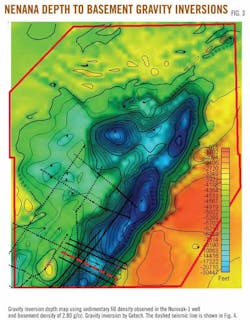
Seismic depth calibration to the Nunivak-1 well, drilled to 11,136 ft (11,075 ft true vertical depth) in 2009, suggests the Nenana basin is about 25,000 ft deep. Inversion of gravity data and a gravity-aeromagnetic basement interpretation support these basin depths and show the general basin architecture.
Geochemical (RockEval) analyses from Nunivak-1 highlight marginally mature Late Paleocene coal and coaly shale with excellent source potential. These coals generate impressive RockEval S2 peaks up to 189 mg/g (average 90 mg/g) and HI up to 379 (average 240).
Using the temperature gradient observed in the Nunivak-1 well, basin geohistory modeling and calculations suggests coaly source rocks below 13,000 ft have expelled billions of barrels of oil. Supporting the potential for prolific expulsion, surface soil cores and lake bottom sediment samples contain thermogenic oil from C2 to C6 in parts per million quantities.
Fluorescent spectral analysis of surface samples detects surface oils of moderate gravity in the C6-12 range. A robust source system appears to be in place. Only one deep well has been drilled in these rift basins, and additional seismic and drilling is needed to evaluate their hydrocarbon potential.
Structure
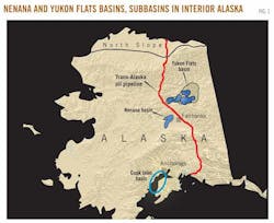
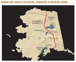
Several nonmarine rift basins formed in interior Alaska (Fig. 1) in response to crustal extension (Nenana basin) and strike slip movement along curved, regional faults (Yukon Flats).
The Yukon Flats includes about 12,000 sq miles and consists of several rift subbasins that formed on the northern margin of the right-lateral Tintina fault. Within the Yukon Flats, large normal faults have localized subsidence, but the entire region has also experienced structural sag and sedimentary deposition, probably intermittent, since the Late Cretaceous.
Judging by surrounding outcrops, the sedimentary rift basins developed on plutonic and metamorphic basement rocks. The Nenana basin, located southwest and separate from the Yukon Flats, is a structural half-graben with a large, normal basin bounding fault on the southeast margin. This fault forms an asymmetrical basin with a relatively steep southeast and a gentle northwest flank.
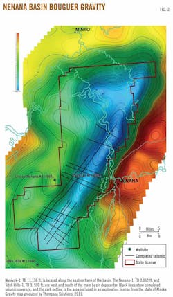
New surface gravity data collected in the northern part of Nenana basin are incorporated into the Bouguer gravity map and show the basin geometry (Fig. 2). The Nenana basin is elongate in a NE-SW direction, covers about 2,000 sq miles, and widens in the north. The Bouguer gravity map indicates that the deepest part of the Nenana basin is generally in the north. The depth of the Nenana basin is important in developing a robust and prolific oil kitchen. A gravity inversion basement map shows the maximum basin depth is about 30,000 ft (Fig. 3).


